. 05/10/2024 12:07 PM
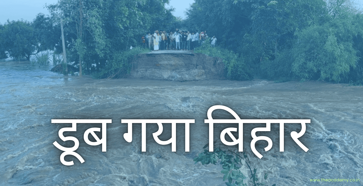
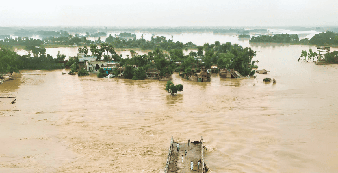
Bihar, particularly its northern region, is acutely vulnerable to flooding, affecting 76% of the state's population. This area accounts for 16.5% of India's flood-affected land and 22.1% of its flood-impacted population. Despite numerous efforts over the years, the state continues to grapple with severe flooding, which has worsened in frequency and intensity. Bihar is currently facing a significant flood crisis, with over 1.18 million people displaced due to rising water levels. Residents are relying on air-dropped food and makeshift shelters while contending with heightened risks of water-borne diseases. The situation has become dire, as persistent rainfall in Nepal's watershed areas has led to dangerous conditions across several rivers in Bihar. Bihar is one of India’s most flood-prone states, with 76% of its population living in regions regularly threatened by flood devastation. The state’s geography, combined with climate factors and human encroachment, has made it particularly susceptible to flooding. Major rivers such as the Kosi, Gandak, and Bagmati overflow their banks during the monsoon season, resulting in catastrophic impacts. Geographical Location: Bihar’s position downstream from the Himalayan foothills means that heavy rainfall in Nepal can quickly result in overflowing rivers that flood into its low-lying plains. Urbanization of Flood Plains: Increasing habitation in flood-prone areas amplifies the risks associated with rising river levels, leading to greater devastation. Deforestation in Nepal: The transformation of forests into agricultural land in Nepal's middle hills has increased runoff, contributing to flooding in Bihar. Sediment Build-Up: Rivers like the Kosi have experienced significant sediment accumulation, narrowing their channels and reducing their capacity to manage high water volumes. Embankment Failures: Although around 3,000 km of embankments have been constructed, these structures often fail due to increased river volumes and sedimentation. Although floods in Bihar do not always result in significant loss of life, the economic toll is substantial. Damage to crops, livestock, and infrastructure creates long-term challenges for the state. The distress migration that often follows exacerbates economic vulnerabilities, with the government spending approximately Rs 1,000 crore annually on flood relief and management. To combat the recurring flooding, the Bihar government has introduced several measures: Emergency Response Mechanisms: Establishment of State Disaster Response Forces (SDRF) and Emergency Operation Centers (EOC) to manage rescue and relief efforts effectively. Procurement of Essential Supplies: The government has procured motorboats, life jackets, tents, and other necessities for flood-prone districts. Public Awareness Campaigns: Initiatives aimed at educating residents about disaster risk reduction and preparedness strategies. Early Warning Systems: Development of coordinated systems for assessing risks, forecasting hazards, and conducting communication exercises. To mitigate the impact of flooding, various solutions have been proposed: Improving Infrastructure: Enhancing and maintaining embankments to withstand increasing river volumes. Building Detention Basins: Utilizing natural depressions, known locally as chaurs, to absorb flood water effectively. Channel Improvement: Increasing the capacity of rivers through straightening, clearing vegetation, and deepening channels. Implementing Comprehensive Disaster Management Plans: Developing a multi-faceted approach that integrates both structural and non-structural solutions, including community engagement and preparedness initiatives. The Flood Management Information Systems Cell in Bihar categorizes floods into four types: Rapid Flooding: Quick onset floods triggered by rainfall in Nepal, with a lead time of about 8 hours. Riverine Floods: Caused by overflowing rivers, these floods typically have a 24-hour lead time. Congestion Flooding at River Confluences: Develops over more than 24 hours and can persist throughout the monsoon season. Permanently Waterlogged Areas: Regions that experience constant waterlogging year-round. Bihar's flooding crisis is primarily influenced by eight major rivers that flow through the region, all of which eventually empty into the Ganges. These include: Ghaghra Gandak Burhi Gandak Bagmati Kamala Bhutahi Balan Kosi Mahananda Bihar's flooding crisis is deeply rooted in a combination of geographical, environmental, and infrastructural challenges. While government initiatives aim to address these issues, the complexity of the situation necessitates a multifaceted approach that integrates both structural and non-structural solutions. Without comprehensive planning and community involvement, the state’s struggle with annual floods is likely to persist.Why in the News?
Bihar’s Vulnerability
.png1728111029.png)
Why is Bihar Prone to Annual Flooding?
What is the Economic Impact of Bihar’s Floods?
What are the Government Initiatives to Address Flooding?
What are the Possible Solutions?
What are the Types of Floods in Bihar?
Which are the Affected Rivers?
Conclusion